For Mirela Tulbure, using big data to delve into the dynamics of rivers, streams and other surface waters merges two passions––exploring the rich potential of satellite imagery and answering pressing environmental questions.
Tulbure joined NC State at the start of Fall 2019 as a tenured associate professor in the Department of Forestry and Environmental Resources (FER), and as the newest member of the Geospatial Analytics faculty cluster established by the Chancellor’s Faculty Excellence Program.
As a member of the cluster, Tulbure also joins the Center for Geospatial Analytics as a faculty fellow and member of the center’s steering committee.
“Mirela is a phenomenal remote sensing scientist, and it has been a huge score to bring her to NC State,” says Ross Meentemeyer, director of the center and a foundational member of the cluster. “We expect her to play a key role in the growth of the cluster and in helping to shape future research directions here at the center.”
“We are pleased that Dr. Tulbure elected to join the department and we are excited for her potential to collaborate with faculty in the department, center and other NC State faculty,” adds Tom Gower, head of the Department of Forestry and Environmental Resources in the College of Natural Resources. “Drs. Tulbure, Josh Gray and Stacy Nelson, all tenure-track FER faculty, provide a critical mass of remote sensing scientists in the department.”
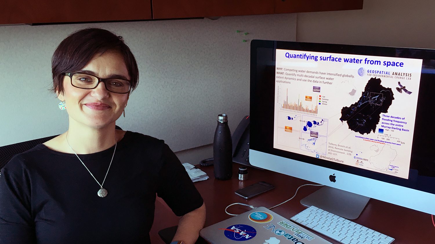
Before coming to NC State, Tulbure was a faculty member at the University of New South Wales in Sydney, Australia, where she led a research group studying how (and why) water extent has fluctuated across the Murray-Darling Basin in Australia’s arid southeast. The basin is about the size of the four-corner states in the US, Tulbure explains, and she found that land use change, climate variability and large-scale weather patterns like La Niña all influenced surface water extent in the area, over time scales ranging from seasons to decades.
At the Center for Geospatial Analytics’ September 5th Geospatial Forum, Tulbure detailed the motivations and impacts of her work in Australia, explaining how her approaches will translate to future work in the Southeast US.
“I’ve always been fascinated by water,” Tulbure says when asked about how she chose her current field. “Water is such an important resource, so important to people, to the environment, to everything we do.” While a postdoctoral researcher at South Dakota State University, she first began working with the extensive Landsat satellite imagery archive, and discovered that merging water issues with remote sensing was her research destiny. “It became clear––this is a perfect merge of skills for me. This would be my path.”
At NC State, Tulbure sees the Geospatial Analytics faculty cluster and the Center for Geospatial Analytics as incubators for future innovative work. She applauds NC State for building “a critical mass of geospatial analytics researchers” and the center in particular for uniting experts from myriad disciplines across campus with its faculty fellows program.
“My work is very interdisciplinary,” Tulbure explains. “I like data-driven research––using machine-learning to develop a new dataset and then using that dataset in an application.” Chatting with others from different fields, she says, can often “spark your next brilliant idea.”
Tulbure was also drawn to NC State by the recently launched Geospatial Analytics Ph.D. program, and the prospect of helping to shape the cutting-edge program as it grows. She will teach one of its six core courses, GIS 712: “Environmental Earth Observation and Remote Sensing.” She is also advising two of the program’s newest students.
“That is the highlight of my job,” Tulbure says with a smile, “mentoring Ph.D. students and watching them succeed.” Her new students will form the foundation of her new research group at NC State. “I am very excited to have two students starting at the same time as me. They’ll be an important part of what I do.”
This post was originally published in Center for Geospatial Analytics.